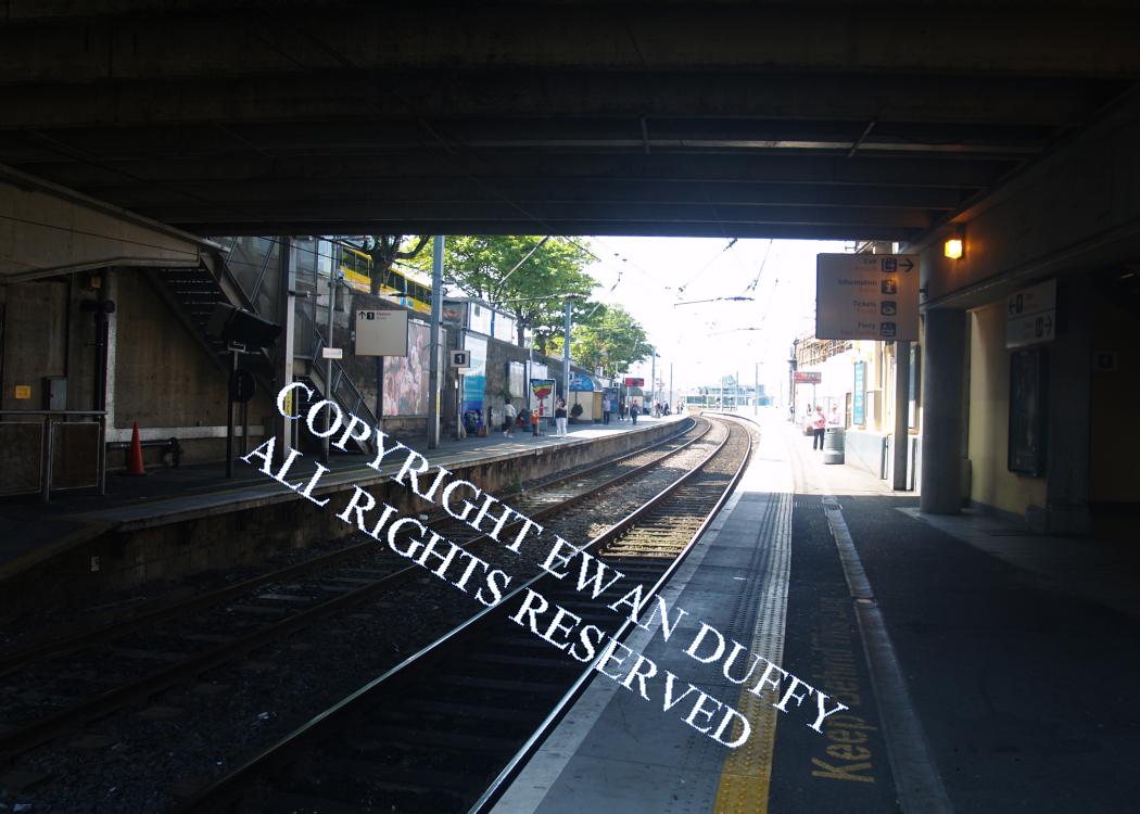
Site Description
Approaching the station, there is an electricity sub station for the DART on the Up side, beside which is the signal interlocking and a radio aerial. Opposite this, a siding diverges into the site of the 1837 D&KR extension. There was formerly an island platform here, being numbered 1 & 2. This has been replaced by a single platform. The two through platforms are on the site of the Atmospheric railway station. There was previously a siding and facing headshunt on the Up side beside the electricity sub station. The main station building, opened in 1998, is elevated over the line at the Rosslare end of the station, accessible from road level. There is a plaque commemorating the opening of the new building. Lift access to both platforms is provided. The previously used station building remains on the Down platform. The original station building - built using Murphystown granite for the basement level and Ballyknockan granite for the upper level - is above the line and to the left of it, also at the Rosslare end of the station. It is now an upmarket restaurant. There is a disused flight of stairs leading from this to the concourse. Outside this building, there is a plaque commemorating the addition of the name "Mallin" to the station in 1966, although this suffix is rarely, if ever used. There were previously three pier sidings off the mainline, one to the Victoria or St Michael's Wharf was opened in 1891 at the expense of the War Department at cost of 1,174.10s.0d. Another - the "Mineral Wharf" - was installed in 1863 for the export of mineral traffic from Avoca. Both were at the north end of the station on the seaward side. These connections were closed in 1966. The line through the station was originally single and this pertained up until 1957, when the track layout at the Rosslare end of the station was revised to that that exists today. The Up platform was added simultaneously. Beyond the station, the third pier siding diverged on the Down side to serve the now demolished Carlisle Pier station. This connection was closed in 1980, due to differing levels between it and the lowered track through the mainline cutting and due to the sharp curvature of the tunnel itself. In its day, it had its own signal box in the tunnel, controlling the junction. The track from here to just south of Sandycove & Glasthule was a concrete slab for almost 30 years. Installed in 1981, supposedly to give trouble free maintenance through this infrastructurally difficult stretch of line, it was removed in the 21st Century as life expired.Photographs
Photo Gallery - Dun Laoghaire Station
Google Street View - Dun Laoghaire Station
Geograph.ie - Irish Lights siding (Link checked 28072021)
Geograph.ie - outer wall of 1837 station (Link checked 28072021)
Geograph.ie - Station (Link checked 28072021)
Geograph.ie - Station (Link checked 28072021)
Dun Laoghaire Station (Link checked 28072021)
Links
Irish Rail Station Information - Dun Laoghaire (Link checked 28072021)
Chronological Details
| Opened | Closed | Company | Name | Notes |
|---|---|---|---|---|
| 29/03/1844 | 12/04/1854 | D&KR | Kingstown Harbour | End of atmospheric services |
| 10/10/1855 | 20/03/1856 | DW&WR | Kingstown Harbour | Closed due to state of line to Dalkey |
| 01/07/1856 | / /1861 | D&WR | Kingstown Harbour | RN 1861 |
| / /1861 | / /1922 | D&WR | Kingstown | RN 1922 |
| / /1922 | 09/04/1966 | D&SER | Dun Laoghaire | RN |
| 10/04/1966 | / /Open | CIE | Dun Laoghaire Mallin |
Geographical Details
| Section Start | Section Finish | Distance | Units | Milepost | Measured from |
|---|---|---|---|---|---|
| Connolly Station | Rosslare Europort | 7.05 | Miles | 6 | Pearse Station |